Mobile Mapping
Mobile Mapping
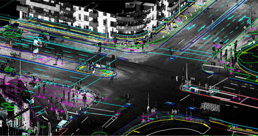
- Mobile Mapping Systems are the combination of various navigation and remote sensing technologies on a common moving platform.
- They are capable of providing fast, efficient and complete data collection. There are often three main components in MMS: positioning system, camera(s) and lidar.
- The positioning is done through GPS/GNSS and inertial measurement units. By using these systems, the data can be recorded continuously and accurately.
- The images recorded are taken through the use of RGB cameras that are equipped with a CMOS global shutter or CCD sensor through which the colored images of persons and objects are acquired.
- Lidar, Light Detection and Ranging, is a remote sensing method that uses light in the form of pulsed laser to measure ranges to the Earth.
CONTACT INFO
- Address: MIddle East Commercial Centre Office #40, FIfth Floor Madinat AL Umal, Al Khobar Kingdom of Saudi Arbia.
- E-mail: info@sintechs.com